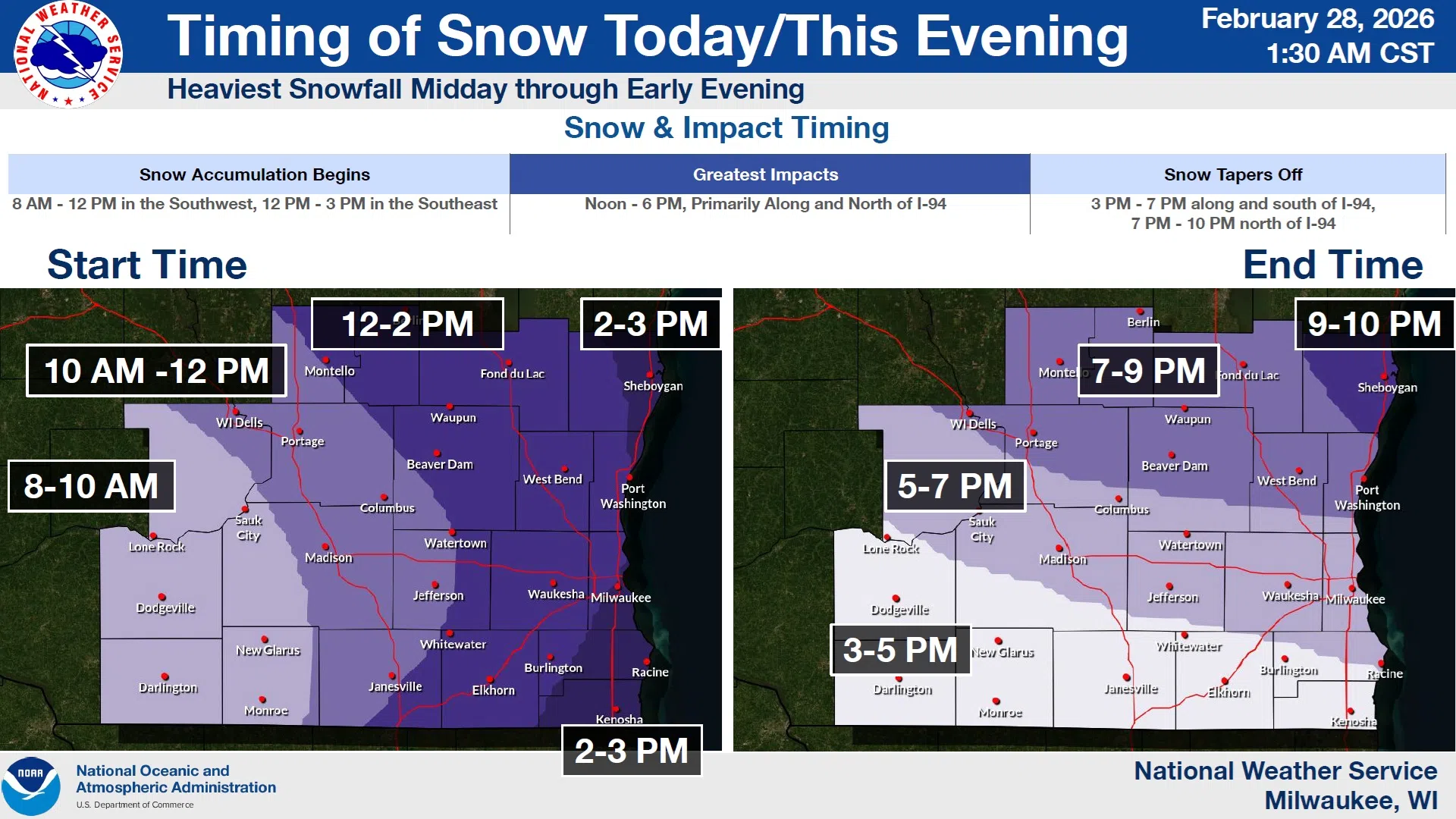
A clearer picture of a passing weather system has the National Weather Service revising expectations of snowfall in the Sheboygan area, making for an easier-than-initially expected outcome.
Whereas Friday forecasts hinted at up to 4 inches of accumulation, persistent dry air and a later arrival time forced revisions places snowfall between the hours of 3 and 10 PM. And although there was still an outside chance of higher totals, most forecasts leaned toward an inch, maybe more in most of the area, and most snowfall before noon was happening south and west of Sheboygan County.
After snow ends tonight, Sunday should see partly sunny, seasonably cold conditions, with a trend toward warmer temperatures sustained in the coming week.


Comments