Expectations of poor weather during the Friday evening commute have become more focused – and tempered – in the sights of National Weather Service forecasters.
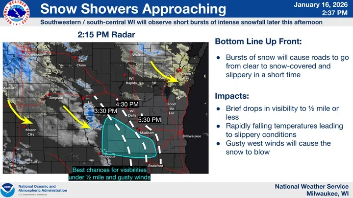
Friday morning snowfall was in the range of 1 – 2 inches throughout Sheboygan County, ending by noon. But by 3 PM, snow showers were rotating into southwestern and south-central Wisconsin from the northwest, and dynamics in that region – generally southwest of a Lone Rock to Madison to Richland Center line – are likely to generate brief, intense bursts of snow that temporarily reduce visibility and create slick roadways. But by the time those showers would eventually reach east-central areas the intensity should be spent, and accumulations here should be limited to around a half an inch.
Another inch or more could accumulate in periods of snow late tonight through midday Saturday, but totals around 2 inches seem reasonable.
Attention then turns to falling temperatures on Sunday, leading to bitter cold by Monday morning. Forecasters are weighing the issuance of advisories or warnings, with expectations that the actual temperatures in Sheboygan County could sink below zero by Monday morning, accompanied by wind chills possibly exceeding 25 below.

NWS Graphic Forecast for Sheboygan County Sunday – Tuesday, Showing Temperatures, Dewpoints, Winds and Wind Chill Values


Comments