As the next powerful storm gets its act together in the southwest US, forecasters in Wisconsin are preparing for a busy Friday night.
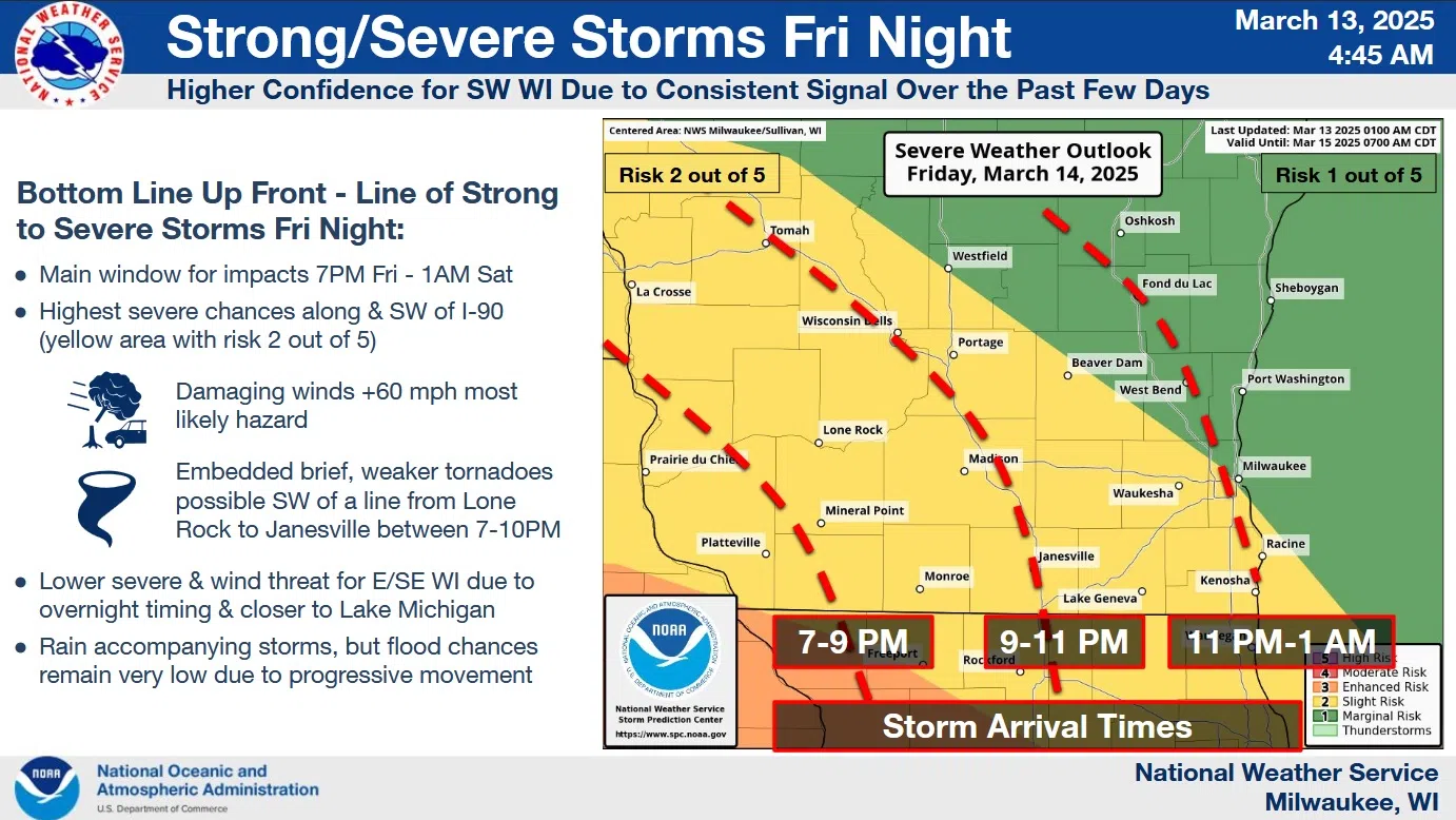
The severe storm potential has been shifted north, but still keeps Sheboygan County in a 1-in-5, or marginal risk, of storms that could produce straight-line winds in excess of 60 mph. But southwest of a Milwaukee to Tomah line, the risk increases to a level-2. While weak tornadoes aren’t being ruled out, those are only expected southwest of a Lone Rock to Janesville line between 7 and 10 p.m.
NWS Graphic
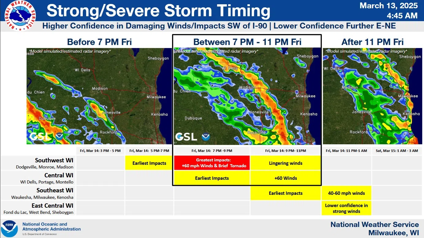
For the Sheboygan area, the risk of high winds is less than in most of southern Wisconsin as the storms are expected to move through after 11 p.m., spending much of their energy before they arrive. Nonetheless, uncertainty remains in that respect.
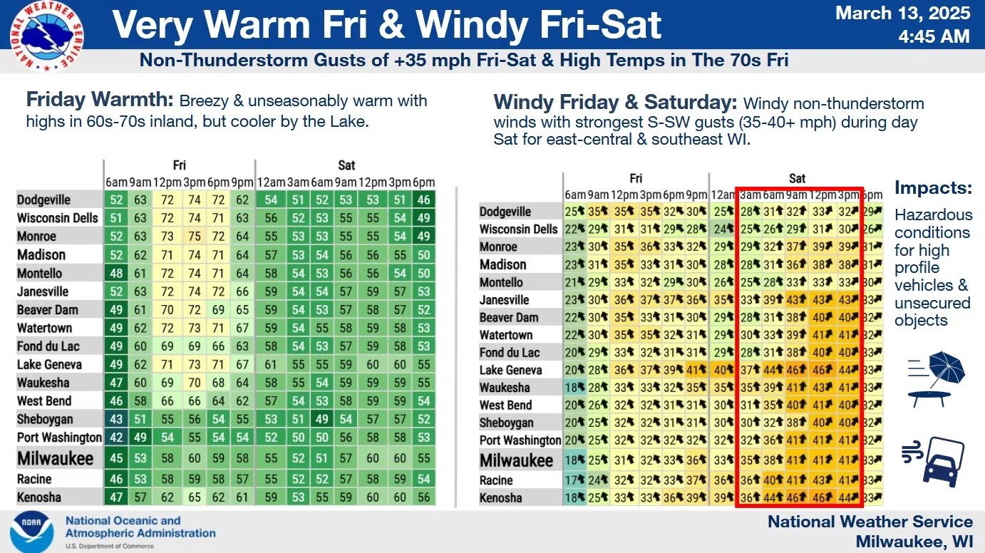
Ahead of those storms, a classic “cooler near the lake” forecast is shaping up as brisk southeast winds funnel in air that’s been stripped of much of its warmth before coming onshore. As a result, we’ll see highs around 56 on Friday while Fond du Lac approaches 70, and most locations west of I-41 likely enjoy highs some 20 degrees warmer than we.
NWS Graphic
In the wake of Friday night thunderstorms, winds could accelerate to advisory levels with gusts exceeding 40 mph in many spots. But by then, Lake Michigan becomes a non-factor with everyone probably experiencing highs in the mid-50s under partly sunny skies.


Comments