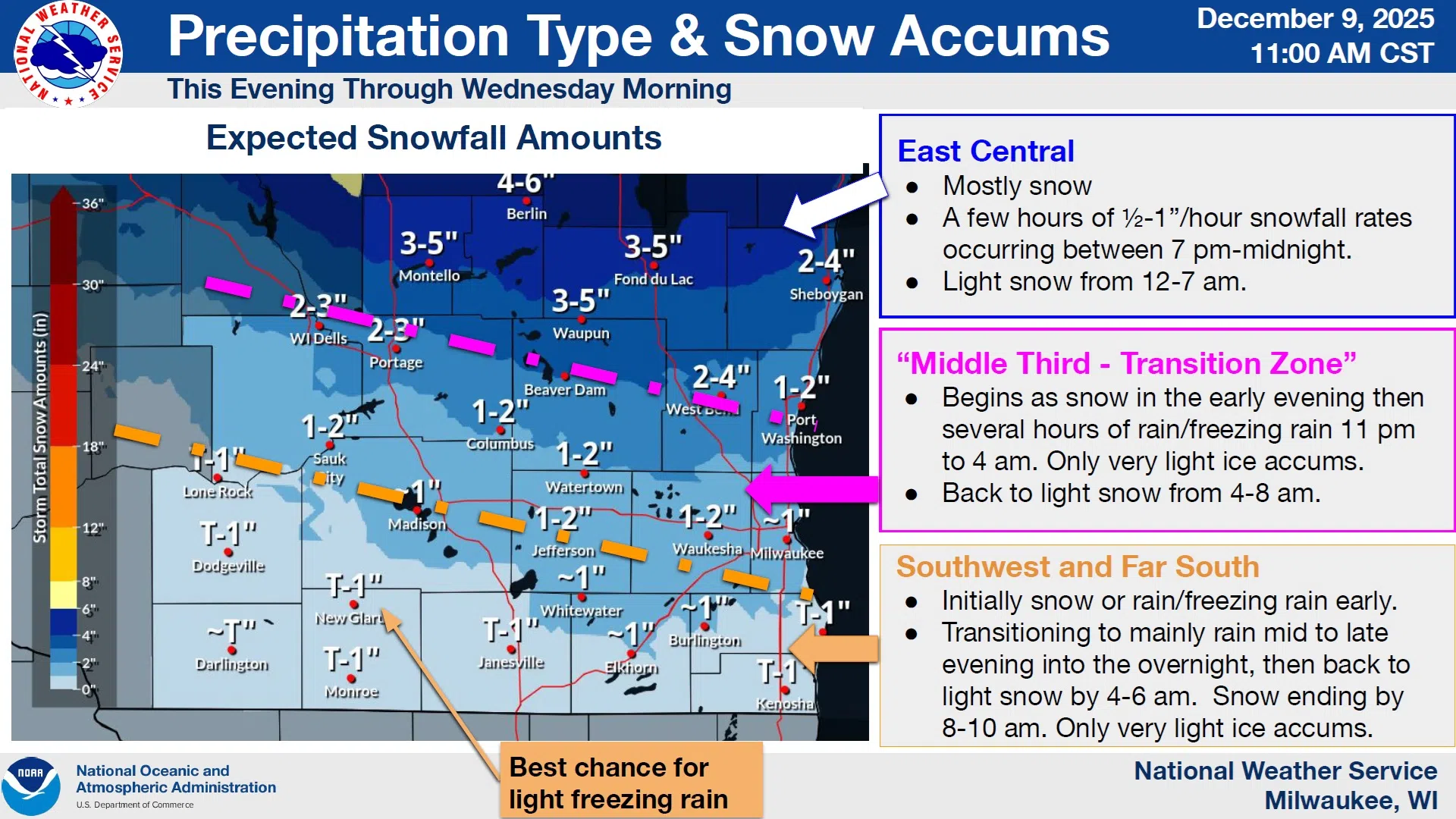
Sheboygan County is in for a quick-hitting round of winter weather according to National Weather Service forecasters.
A Winter Weather Advisory remains in effect from 6 this evening until 6 tomorrow morning, with the main concern being that of accumulating snow on roadways. But along with the snow factor, there’s a chance that any light rain or drizzle present in the snow could cause glazing. That, however, is more likely to happen the further south one goes. As for snow totals, that all depends upon location.
Sheboygan County is likely to receive 3-5 inches in the northwest quarter, 2-4 inches in the central portion, and 1-2” in the far southeast. The most vigorous accumulation is expected from the start of snow this evening through midnight, with lighter amounts to follow until sunrise.
Cold air will begin flowing from the northwest in the wake of the system with steady or slowly falling temperatures in the 20s on Tuesday, eventually bottoming out below zero Wednesday night. Forecasters expect that it won’t be until early next week that temperatures return to more reasonable readings.


Comments