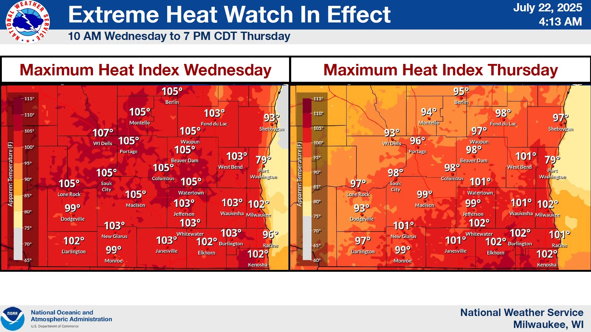
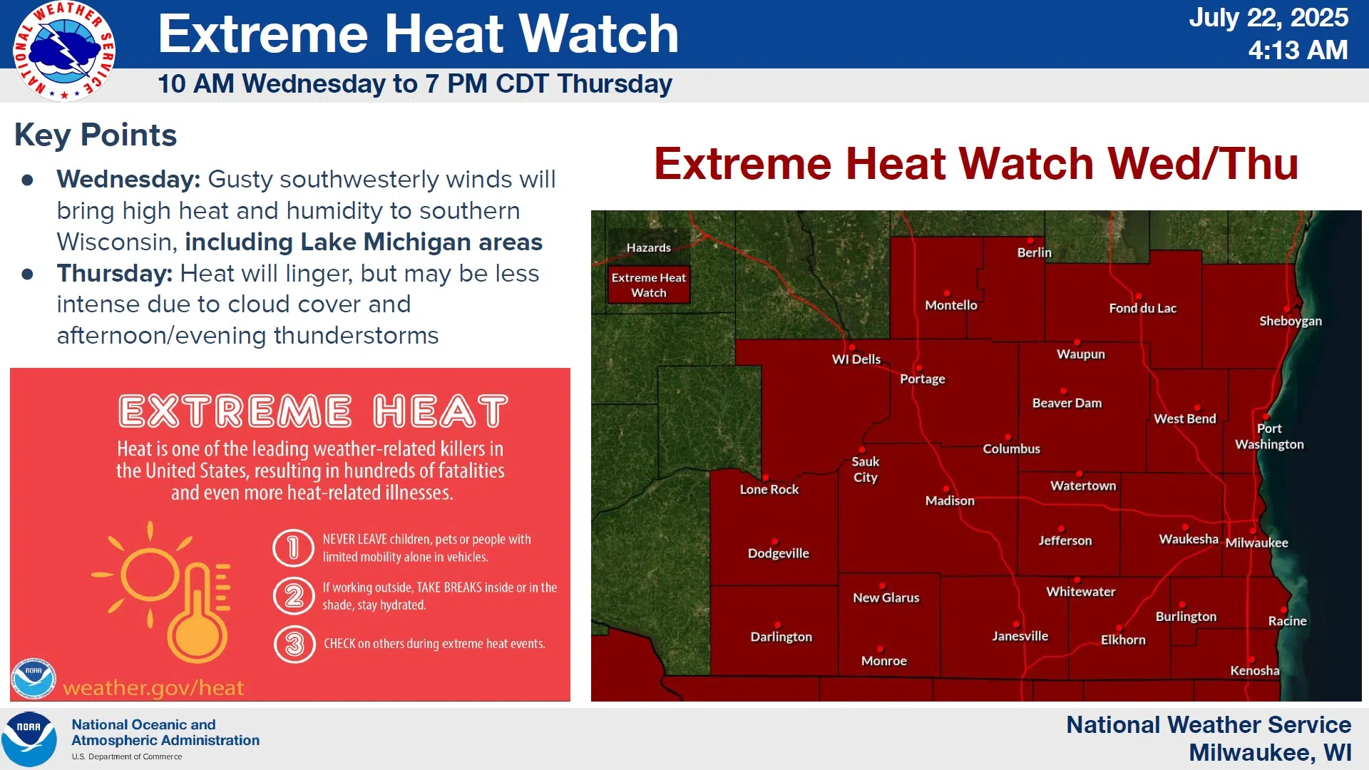
An Extreme Heat Watch remains in effect for Wednesday and Thursday this week when hot, humid weather is expected to push heat index values into dangerous ranges. However, a few changes in the forecast give hope of being spared the worst expectations.
National Weather Service forecasters say that lingering clouds from potential early morning showers & thunderstorms on Wednesday might delay the heat & humidity until later in the afternoon, however heat index values here are still likely to approach triple-digits. A repeat is expected most of the day on Thursday with a greater chance of feeling like 100 degrees or more, when actual temperatures reach highs in the upper 80s. Nighttime cooling won’t be much of a relief with lows expected to remain at 70 or above.
NWS Graphic
Extended relief from summer heat isn’t expected, as highs in the 80s and heat index values in the 90s are again forecast by Sunday.


Comments