As summer-like weather sets into the Sheboygan area, so does the setup for summer-like thunderstorms, and the National Weather Service has its eyes on what may come of it.
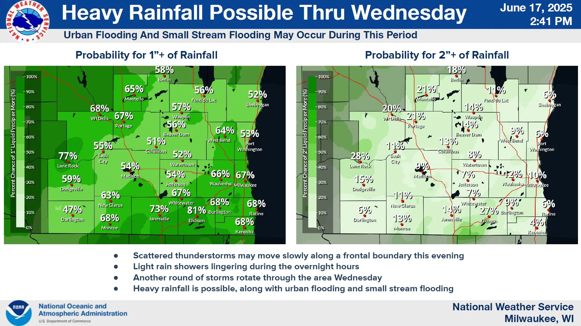
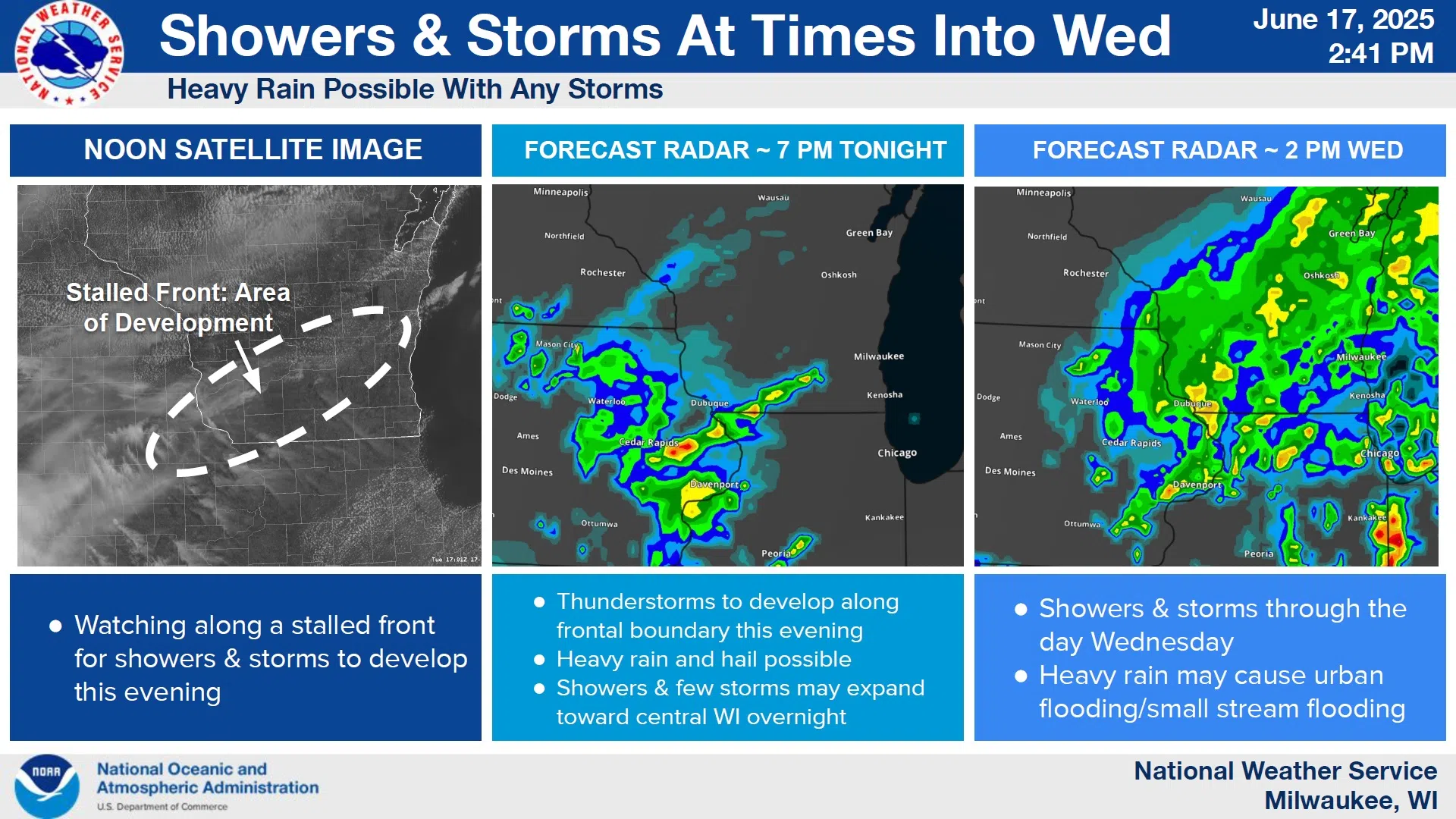
Scattered thunderstorms are forecast to develop along a weak frontal boundary this evening, the strongest of which could produce both heavy rain and large hail. Most of that activity would likely concentrate in the southern counties, but that doesn’t exclude us here.
Another round of scattered thunderstorms are forecast for all day Wednesday across southern Wisconsin. Sheboygan County is given nearly even odds of rainfall in excess of 1”, with the heavy rainfall on Wednesday afternoon likely to pose the main hazard. The potential amounts could cause urban and small stream flooding both this evening and again on Wednesday.
NWS Graphic
A refreshing day in the upper 70s is expected on Thursday, with Friday reintroducing a chance of scattered clouds and storms to boot.


Comments