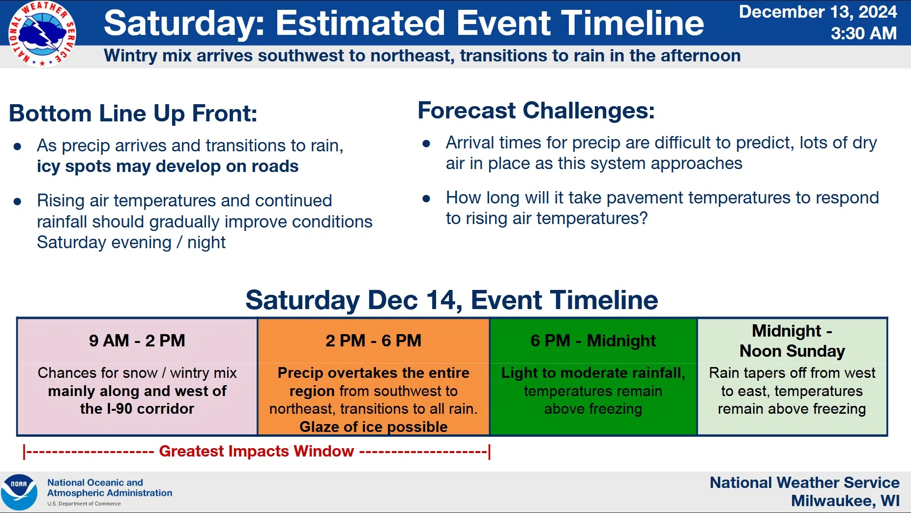
Those planning to travel in Wisconsin on Saturday are being advised to either add extra time or change plans. That from National Weather Service forecasters who see all the ingredients coming together: road surfaces frozen solid by days of near-zero weather, abundant clouds, and the potential for a glaze of ice from a wintery mix and rain.
Predictions are for precipitation beginning as a wintery mix between 9 a.m. and 2 p.m., transitioning to rain, and all progressing from southwest through northeast throughout the day Saturday. While most should fall Saturday evening, the light showers that fall initially will likely form a glaze on roads and other surfaces as warming of those lags behind the air temperature. Shaded areas will be especially vulnerable to slippery conditions.
Rising temperatures and continued rainfall will eventually overcome the freezing tendencies, but that may take until Saturday evening in some areas. Plans should be adjusted accordingly for safety.


Comments