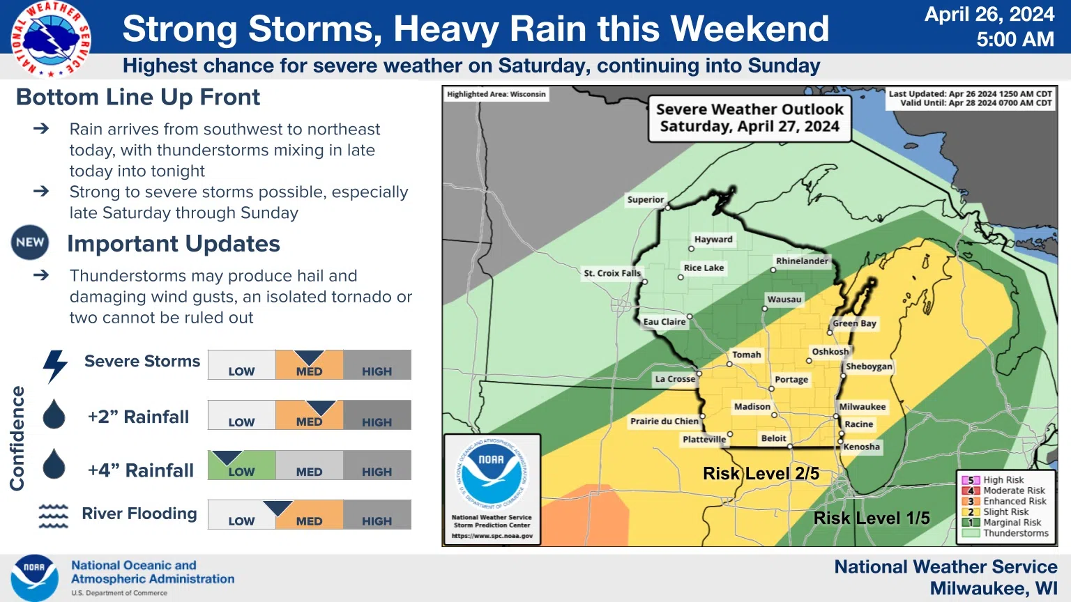
Heavy rains and maybe some severe thunderstorm activity is possible over the Sheboygan area and most of Wisconsin this weekend. The National Weather Service has maintained essentially the same threat map for several days as the needed ingredients come together as expected. Whether or not they succeed in producing dangerous weather remains to be seen, a situation that warrants keeping up with forecasts.
Events begin as rain moves into Wisconsin from the southwest today, with thunderstorms mixing in late today into tonight. But if strong to severe storms do develop they would likely occur late Saturday through Sunday. And while the strongest storms will mainly threaten with hail and damaging winds, an isolated tornado or two can’t be ruled out. As for rainfall locally, forecasters project somewhere between one, and an inch-and-a-half of rain for the duration.
As for any good news…Saturday could be the warmest day of the year so far as gusty southwest winds push temperatures into the low-mid 70s, while rain likely stays away between early morning and late afternoon, a welcome break in what could be an active weather weekend.


Comments